This article appears in the November 2018 issue of Potato Grower.
In the past five years, drones have truly “taken off,” no pun intended. From personal flying cameras to valuable industry tools, the applications and benefits drones can provide seem to be endless.
Within the agricultural industry alone, there is huge potential for drone technology integration into everyday farming and ranching practices. These tasks could include crop scouting, cattle monitoring, fence inspection, checking your center pivot or linear irrigation, and even spraying, just to name a few.
Eye in the Sky
As you stand on the edge of your 160-acre field in the middle of July, what can you see?
I’m going to take a wild guess and say “not much,” especially if your crop is already taller than you are. By putting a simple eye in the sky, you can get tremendous benefits by seeing the uniformity of your crops and target specific “trouble” areas in the field. These areas can then be looked at from the ground, either by you or by your agronomist, to determine the root cause of the issues that would have otherwise never been detected if not viewed from the air.
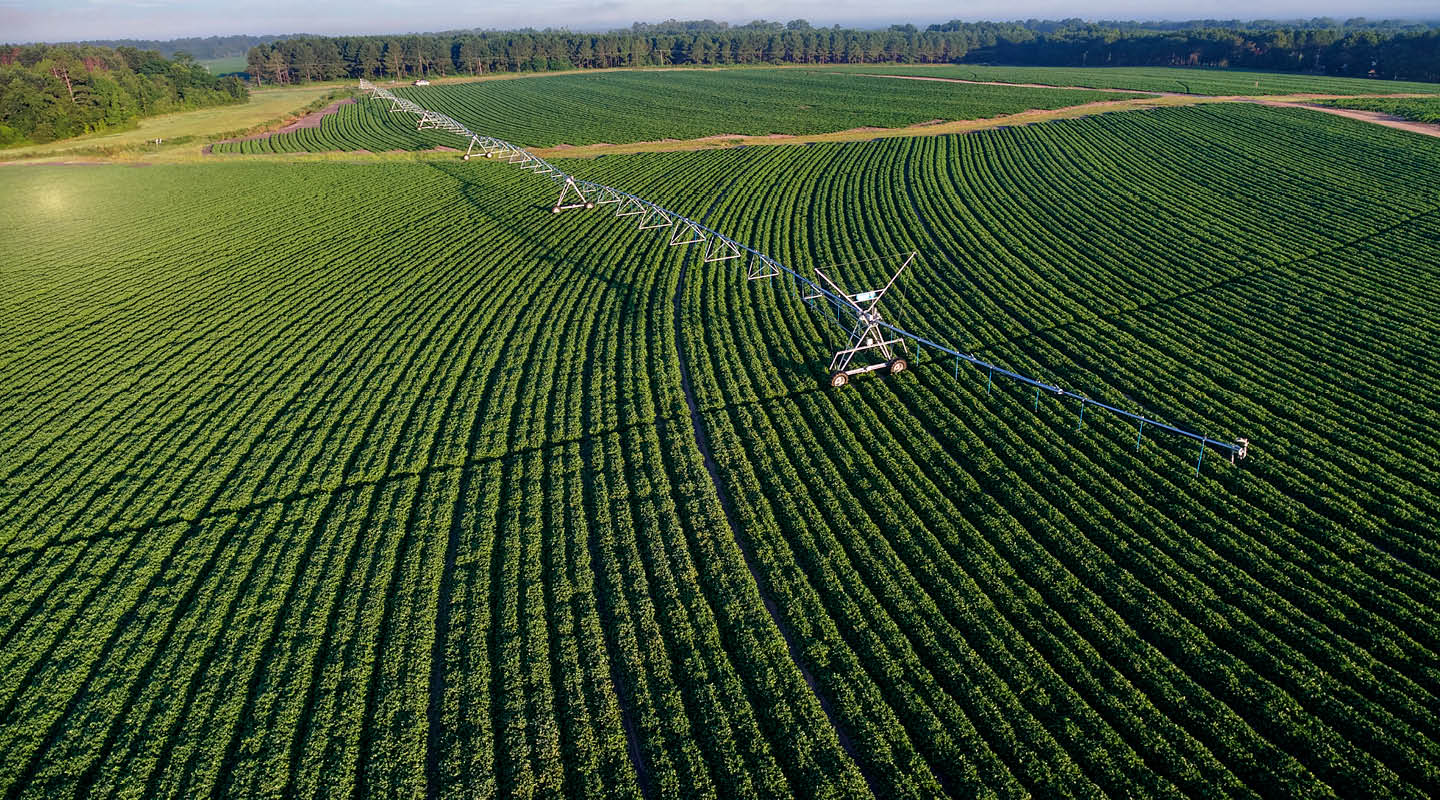
Now imagine that you can get a detailed view of your entire irrigation machine without even having to take a step into the field. Getting an up-close live video of your center pivot’s towers, spans, sprinklers and even tires can keep you up to date on your machine’s well-being. By pinpointing exactly where an issue is present, such as a sprinkler leak or low tire, you can save yourself from having to walk through the field at least twice in the hot summer sun. If you don’t catch something on your first flight, a quick inspection of a machine that needs maintenance could help you identify the root cause prior to your fixing the issue or calling your local irrigation dealer.
A very simple, relatively low-cost (quad-copter style) drone—operating, of course, within FAA regulation parameters— can easily support these tasks within a 160-acre field on a single battery charge.
A Single Snapshot
However, if just having a flying surveillance camera for your crops (not your neighbor’s) isn’t providing the data you need, you may want to consider a mapping approach. By creating a simple grid-based mission within your drone’s ground control station, the drone will fly autonomously while simultaneously collecting all images and data along your designed path.
Later, all this information can be processed into a single high-resolution, geo-located map of your field. Depending on the kind of camera sensor that was flown, such as NDVI, the map could highlight stressed areas in the field that couldn’t be detected by the naked eye. Then these geo-located maps or information could be used to help write variable rate irrigation prescriptions or even adjust your operation’s irrigation management in close collaboration with your agronomist.
Typically, supporting this type of high-accuracy mapping over a large 160-acre field will require a higher-cost, fixed-wing (airplane-style) drone. The key with any agricultural mapping drone is endurance, so that it can capture the entire field on a single battery charge. Additionally, the data processing in a mapping-based approach is equally or even more important than the drone. Luckily, if you want a more hands-off approach, there are many services online that can consistently and quickly process your captured data, allowing you to just focus on flying.
No matter what approach you take, both types of drone use can help you make better irrigation management decisions by allowing easy and fast identification of problem areas in your field or on your irrigation equipment.
Am I Legally Flying?
With the current Federal Aviation Administration (FAA) regulations, the U.S. is no longer the wild, wild West for drones. In 2016, the FAA published the Part 107 drone regulations that apply to commercial drone operation. If you use a drone to gather information for your farm, you are technically operating the drone for commercial use, as deemed by the FAA. This means that to legally use a drone to benefit your operation, you will need to study up and get your remote pilot certificate.
This 60-question multiple choice test can be taken at any FAA-approved knowledge testing center across the U.S. Trust me—the test is not as daunting as it seems; I received my Part 107 back in 2016 when there were limited study tools. Today, there are several great online tools or test prep courses to help prepare you for the exam, and once you pass, you can legally benefit your operation for two whole years.
In my opinion, every operation should have a drone. They provide so many uses, from making a high-resolution NDVI map for VRI prescriptions, to inspecting your pivot ,or even making a cool harvest video. Drones can be a valuable tool to make your operation even more efficient—not to mention that they are fun to fly.
Since every operation is unique, always double check to make sure you’re operating safely and within the Part 107 regulations. For more information on the FAA Part 107 regulations, visit www.knowbeforeyoufly.org.
This article was originally published on Valley Irrigation’s Growing the Conversation blog on Sept. 20, 2018.